Satellites 3
Irwin Williams
Earlier this year, I celebrated planning and delivering my first hackathon in a few years, which itself was a Caribbean-first - a Disaster Mapping Hackathon, focused on The Bahamas, with over 50 participants from all around the world. Collaborating with Dr. Ogundipe has been a joy and an eye-opener for me into this world of geospatial data and machine learning.
We’ve been building the Foresight platform for a few years, and like most innovators, our cache of ideas for it often far exceeds the time and other resources (money, I mean money) you need to get things done. Yet, we had an opportunity to extend Foresight into Disaster Mapping in a very groovy way.
Already having the capability of lending support post-disaster, we considered how can historical data be used to predict the potential impact of natural disasters? The result was an upgrade to the Foresight platform to do just that.
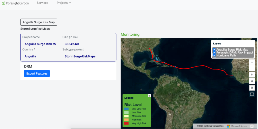
Now, using Foresight, you can view the expected path of a hurricane or other natural disaster, and based on a number of factors determine the potential extent of the damage.
**The images above show the areas at risk of a storm surge due to hurricane Irma (2017).
**The images above are the risk map for a hurricane passing through the Caribbean, with an eye on its impact on The Bahamas.
Using ForesightDRM you would be able to assess which areas are at risk of storm surges due to an approaching tropical storm or hurricane.
Dr. Ogundipe presented on our approach at the 127th Open Geospatial Consortium gathering in Singapore and shared these words:
It’s funny, as a cloud architect, I’ve not worked much with data about literal clouds, so I find the kind of architecture we created to do this work to be exciting, though, not without its frustration. Pulling together data and processes from a number of sources, ensuring fidelity, reliability and robustness demands that you are quick on your feet, and are even quicker with your backups.
I’ve been happy to learn about the rigours of ML applied to the massive datasets involved in transforming satellite data into actionable information and with that, support extending the Foresight platform to be one of the premier places you can come to learn about whats happening on the planet.
https://foresightcarbon.com/
Related:
- Tutorial Walkthroughs - Request Splitter
- The Blogging World with Artificial Intelligence: How AI Changes The Rules of the Game
- Azure Skills Navigator (a real one)
- GitHub Copilot: A young Jarvis?
- Learning to scale.
- Exploring the differences between SaaS, PaaS and IaaS
- Cloud Technologies - 2017. Ready, class 1
- Teaching Cloud Technologies (2016/2017)
- Teaching Cloud
- Teaching (again)


